Before turning in for the night I decided to set up the GNSS base and link up the Sirius Pro UAV to see how the real ground would be, compared to our satellite based ground model. There was no flight planned so I powered up the laptop and Sirius without attaching the wings and lay it on the ice. This meant I could check the compass orientation and check a flight plan against the reality.
The ground model was surprisingly good for ice and this gave me some confidence we would be able to make successful flights later in the week, when we had completed the GNSS and Total station work.
Today was the first “real” survey day and I was keen to get started. Up early with a good breakfast of bacon and egg made by the cretative Seth set us all up for a good start. I set a base station nearby and started transmitting for RTK and data logging to post process later to some of the UNAVCO GNSS stations on the continent.
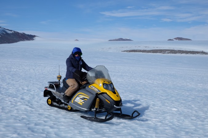
I then fitted the Skidoos with brackets to take a GNSS and FC-5000 field computer each. The GNSS brackets needed a bit of imagination to fix and a few cable ties (note to self for future – cable ties get very brittle and snap easily when cold!).


The Field Computer brackets were designed to mount on a survey pole but worked a treat on the skidoo handlebars with a bit of self amalgamating tape to stop them slipping.
Having the Bing map background was really useful on the field controllers to provide some orientation in an expanse of glacier. Mike and Jim then set off on their Skidoo, logging their journey with RTK GNSS as they went to locate and record Jim’s actual landing and stopping point as well investigate the best location for a potential runway. The second skidoo was used by David and Seth to check out the natural surroundings and record any environmental encounters.
This left me free to establish some points to be used as a base line to survey and height the surrounding mountains with the GT total station. Taking a robotic total station for this task was a bit of overkill as a simple manual total station would have worked well, but it gave me a back up plan to survey the skidoo runs with a fixed prism at speed if we encountered any issues with the GNSS. Happily there were no issues with the GNSS and we got good RTK coverage of the first day’s investigation work.
I marked the location of my two survey points with a piece of black pipe. Obviously black is easy to spot on a white vista, but it also warms up and “melts” into the ice and therefore withstands the strong winds, a good piece of inside knowledge from the experienced hands.
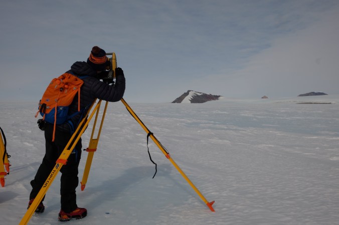
Recording all the tops of the mountains in view was not as easy as I first thought. When looking through the telescope the “top” of some of the mountains were not so obvious and I make notes and sketches to ensure I would be surveying the same point on each face and round. I also took some photos with my phone as a useful reference but inevitably my progress was hampered by the confusion and difficulty in identification of some peaks.
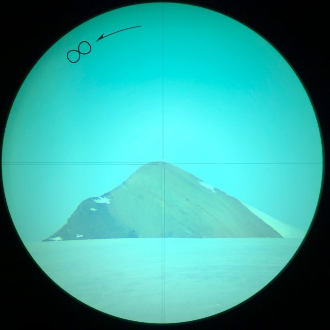
This mountain pictured was several km’s away. The peak was fairly easy to identify unlike some of the other tops – it’s not my reading point for those precise surveyors out there – just an image taken through the telescope to help identify the different peaks 🙂 .
The tripod also warmed up and the legs melted into the hard ice during observations, despite my substantial weight pushing them in initially on set up. This led to the total station needing re levelling a few times which was not ideal for this task.
Although I had recorded all I needed and made plenty of identification notes and images from the two stations I was not entirely happy with how this had gone and decided to repeat it again the next day much quicker and earlier in the day, so I would have an independent set of data which was recorded in a short space of time.
One irritating fact on the GT I found was the quick record button on the side. This is a great feature “normally” but when not recording distances and wearing large gloves had a habit of being pressed and recording points while I was making fine adjustments to my sightings. This also would have added confusion to the results with sequential point numbering of the peaks. Something I would also change for the repeat survey in the morning by using specific peak names. It might be possible for this quick measure feature to be disabled but I was not inclined to go looking for the option and preferred to get the job done. It was noticeable colder today with periods of no direct sun but not too bad to work “well dressed” as the wind had dropped during the day.
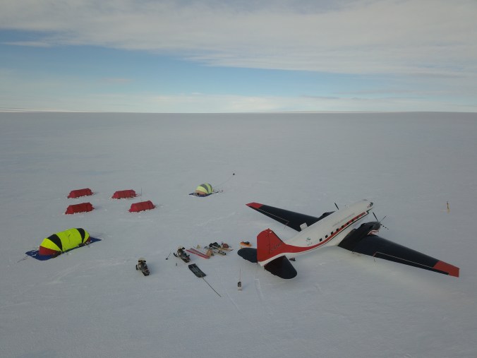
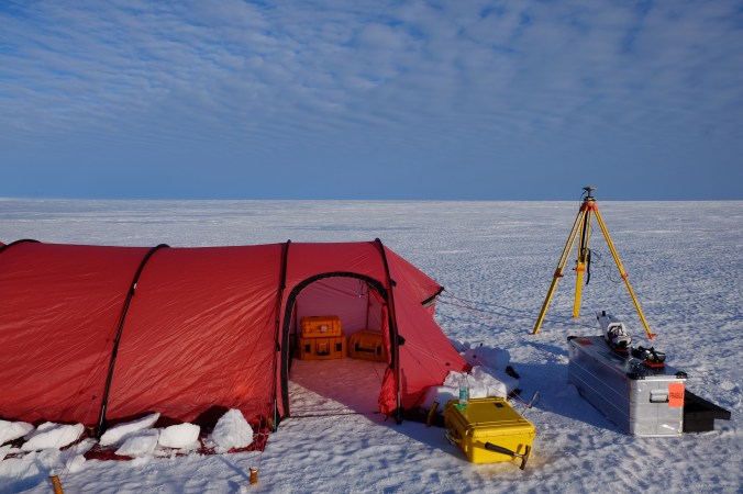
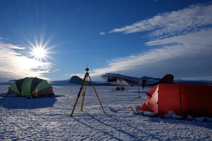
We all gathered back at camp for dinner in our elongated clam Mess Tent, although I got very cold quickly after dinner with the wind now blowing strong so retreated to my tent and my super warm double sleeping bag…..These red Hilleburg tents are very spacey and windproof so perfect when you are tucked up inside. Top class tents.
